Drought threat for all of Tonga, but national El Niño plan not finished
Tuífua Vailena | 22 October 2026
Every island group in Tonga could be in drought by the end of this month, the Kingdom’s Meteorological Service has warned.
In its September drought outlook, the service put the chance of very dry conditions across Tonga from September to November at 80 to 100 percent. It said a very strong El Niño could develop towards the end of the year.
The World Meteorological Organization says El Niño is strengthening in the tropical Pacific and is expected to last into early 2027.
The Met Service projected that all six island groups monitored for drought (Tongatapu, ʻEua, Haʻapai, Vavaʻu, Niuatoputapu and Niuafoʻou) could reach drought declaration status by the end of October.
When the outlook was issued, four groups were already under drought declarations: Tongatapu, Haʻapai, ʻEua and Niuatoputapu. Niuafoʻou was under a drought warning and Vavaʻu was under a drought alert. RNZ Pacific reported on 9 October that those classifications had not changed. The Met Service had not published an October update at the time of publication.
These are meteorological drought classifications. They are not the same as declaring a national disaster.
Seluvaia Ilolahia, the Met Service’s chief climate officer, told RNZ Pacific that Tonga is going through serious drought conditions. She said some rain had fallen in Vavaʻu, but the rest of the country had been below average. The warnings will stay in place for the next three months, she said.
She said El Niño was still very strong and was likely to peak around November to December. But she warned that the dry weather’s effects could last well beyond that.
“The impacts might come later, even after the event, we will still feel it,” Ilolahia said.
Months of low rain
Rain has been scarce for months. In June, Niuatoputapu received just 10 millimetres, about 93 percent less than usual, according to the Tonga Meteorological Service. Haʻapai’s rainfall was down by about 80 percent. Only Vavaʻu had more rain than normal.
The dry weather continued through July and August.
The four island groups already in drought are home to about 85 percent of Tonga’s people.
Tonga has seen this pattern before. One of the strongest El Niño events on record, in 1982–83, shows how much damage these events can do, and why early warning matters.
Factbox: June rainfall by station
Station | June rainfall (mm) | Compared with June average |
Niuatoputapu | 10 | About 93% below |
Haʻapai | 19.9 | About 80% below |
Fuaʻamotu | 30.2 | About 77% below |
Nukuʻalofa | 37 | Below average |
ʻEua | 45.5 | Below average |
Vavaʻu | 148.2 | Above average |
Source: Tonga Meteorological Service. Compared with the service’s 30-year June averages.
What the 1982–83 El Niño taught forecasters
El Niño is a shift in the Pacific Ocean that happens every few years. The trade winds weaken, warm water spreads east, and rain patterns across the Pacific change. For Tonga, it usually means less rain.
The 1982–83 event is the subject of an ABC documentary, presented by Matt Bevan for the If You’re Listening series. It looks at what happened and how scientists learned to see such events coming.
Australia went into severe drought in 1982. Farmers had to cut livestock numbers because there was not enough feed or water. On 8 February 1983, a huge dust storm swept over Melbourne. Eight days later, the Ash Wednesday bushfires killed 75 people and destroyed or badly damaged about 2,000 homes.
The effects were different elsewhere. Indonesia suffered drought, while parts of South America flooded.
The documentary’s main lesson is that communities were largely unprepared. Reliable seasonal forecasts did not yet exist.
That began to change through the work of Australian scientists Neville Nicholls and John McBride. They studied the Southern Oscillation Index, a measure of the difference in air pressure between Tahiti and Darwin. Their research showed that changes in Pacific air pressure could help predict rainfall months ahead. It became an important foundation for the seasonal forecasts used today, including the drought outlooks issued by the Tonga Meteorological Service.
The documentary also looks at research suggesting climate change could make extreme El Niño events more frequent or more intense.
But it adds a warning. The 2023 El Niño did not bring the severe Australian drought that some had expected.
El Niño makes dry conditions more likely. It does not guarantee them. That is why forecasters look at the full seasonal outlook, not a single indicator.
For Tonga, the difference from 1982 is that the warning has already come. The question is what has been done with it.

What a long dry spell means for Tonga
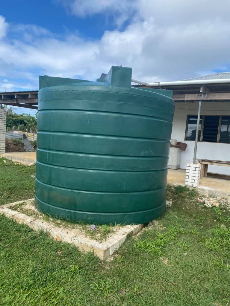
The Met Service’s September assessment lists the likely effects. Household rainwater tanks run low. Groundwater comes under pressure. Drinking water costs more. Harvests shrink.
Farmers could struggle to grow yams, taro, manioke and other crops. Livestock could suffer from a lack of water and feed. The report also flags risks to health, sanitation, schools and emergency services.
The service lists these as possible effects, not ones already seen.
The risk is greatest for families who rely on rainwater. In the 2016 Census, water tanks were the main source of drinking water for 99 percent of households in the Niuas and 96 percent in Haʻapai and ʻEua. Even on Tongatapu, the figure was 76 percent.
When the rain stops, those tanks empty. In remote villages and on the outer islands, families have few other places to turn.
The Government’s response so far
On 3 August, the Prime Minister’s Office said Prime Minister Lord Fakafanua had ordered drought relief supplies sent to Haʻapai straight away, after a drought declaration for the island group. Water tanks and other supplies were shipped with help from His Majesty’s Armed Forces. The office described the current event as a “Super El Niño”.
The statement did not say how many tanks were sent, how many communities received help, or whether the supplies would last through a longer drought.
Ilolahia told RNZ Pacific the Met Service works closely with the National Disaster Office, which in turn works with the Red Cross and other non-government groups to respond to community needs, including taking water to the islands.
On 5 October, the Ministry of Finance announced work with MEIDECC and Australian-funded technical advisers to improve emergency buying ahead of El Niño and the 2027 cyclone season. More working sessions were planned to agree on priority actions and a practical plan.
What is not yet public is whether those plans are now in place, and whether water systems, emergency stocks and support for farmers are ready for months of dry weather.
A plan still in draft
In July 2026, the Met Service announced it was developing Tonga’s first National El Niño–Southern Oscillation (ENSO) Directive, with technical help from the Secretariat of the Pacific Regional Environment Programme (SPREP). The directive is meant to set out how government agencies prepare for and respond to El Niño and La Niña events.
SPREP said on 22 October that more consultation was needed before the directive could be finalised.
Three months on, it is still a draft. In an emailed reply to TIN, SPREP confirmed it is helping the Met Service develop the directive and said the document is “still in draft”. It will be made public only once it is complete and approved by the Met Service, SPREP said.
SPREP said the directive aims to improve coordination between national agencies. It is also meant to guide Tonga’s multi-hazard early warning working group when it coordinates the response to El Niño and La Niña events.
That means the plan designed to coordinate Tonga’s response to El Niño is not yet finished, while four island groups are already in drought.
TIN also asked MEIDECC about the directive and the practical steps being taken in response to the drought warnings. We followed up with a second request. At the time of publication, the ministry had not acknowledged or answered either request.
The ministry’s silence does not mean nothing is being done. But it leaves key questions unanswered:
- Are water supplies and emergency reserves enough for a long drought?
- What extra help is available to farmers?
- How will vulnerable communities be supported if conditions get worse?
- Have the planned emergency buying measures become working arrangements?
In 1982, there was no forecast to act on. This time there is. TIN will keep following the Government’s drought preparations as more information becomes available.